
 Fotografía cedida por Gobierno de Navarra
Ruta 19 Sendero de Orgi
- Salida Lizaso
- Distancia 8,40 km
- Desnivel 100 m
SENDERO CIRCULAR QUE NOS ACERCA AL ROBLEDAL DE ORGI PARA CONTEMPLAR EN SU CONJUNTO ESTE BOSQUE. PESE A SU ESCASO DESNIVEL, EL ITINERARIO ASCIENDE HASTA EL ALTO DE GUELBENZU, DESDE DONDE SE PUEDE APRECIAR BUENA PARTE DEL ROBLEDAL.
El recorrido comienza en la carretera NA-4230, en el Área Natural Recreativa de Orgi. Desde este punto, avanzamos en primer lugar por pista hasta Lizaso. Atravesamos la localidad, cruzamos la carretera NA-4110 para salvar el río Arkil y ascender hasta Gorrontz-Olano. Una carretera nos conduce hasta Olano, desde donde obtenemos buenas vistas sobre el valle, el bosque, los pueblos y, al fondo, los montes de la divisoria cántabro-mediterránea. Desde Olano continuamos durante 400 m por la pista que lleva a Venta Guelbenzu para desviarnos a la derecha por una senda entre hayas, y terminar en suave ascensión hasta Guelbenzu. A la altura de la iglesia de esta localidad hallamos las mejores panorámicas de la ruta, con las vistas del bosque de Orgi y el valle de Ultzama. Nos acercamos de nuevo en descenso hacia el río Arkil. Tomamos la pista a la izquierda siguiendo aguas arriba el curso del río, hasta llegar a la granja de la Venta de Guelbenzu. En este punto, tomamos la carretera NA-4110 para cruzar el río Arkil. Poco después nos desviamos por camino a mano derecha para introducirnos en el robledal de Orgi. Desde aquí, llegamos a una nueva pista que nos conduce al Área Natural Recreativa.
de Interés
Bosque de Orgi
El bosque de Orgi es el robledal más conocido del valle de Ultzama. Es un pequeño pero milenario testigo, de unas 80 hectáreas, de lo que fue un extenso bosque. En él se conservan los robles más viejos del norte de Navarra. El robledal fue declarado Área Natural Recreativa en 1996 para conservarlos y fomentar la educación ambiental.
Cómo llegar
Tomar la N-121A hasta Ostiz y en el cruce la NA-411 por Ultzama hacia Lizaso. Poco antes está al Área Natural.
Ruta 20 Caminos de Basaburua
- Salida Lekunberri
- Distancia 18,5 km
- Desnivel: 425 m
RECORRIDO CIRCULAR QUE PARTE DE LEKUNBERRI, CAPITAL DEL VALLE DE LARRAUN, PARA DIRIGIRSE HACIA EL SUDESTE EN BUSCA DEL VECINO VALLE DE BASABURUA, EN EL QUE NOS INTRODUCIMOS. EL REGRESO DISCURRE POR LA CAÑADA DE LAS PROVINCIAS.
El sendero propuesto, de una longitud algo mayor a lo habitual, se inicia en el fondo del llano de la depresión de Lekunberri y avanza en dirección sudeste hasta Udabe pasando dos pequeños collados. El itinerario es circular y regresa por caminos paralelos un poco más al norte. Partimos de la estación del antiguo tren Plazaola, lugar en el que se ubica la Oficina de Turismo. Salimos por la carretera hacia Etxarri para, en el alto, desviarnos hacia la ermita de Santa Cruz y llegar por carretil a Arruitz. De esta localidad salimos por la parte baja del pueblo. Nos adentramos por bosque, en descenso, hasta cruzar la regata Gesal. En el ascenso, llegamos a una pista de concentración que nos conduce hasta Udabe. Desde esta población nos dirigimos hacia Beramendi y, en sus proximidades, enlazamos con la Cañada Real de las Provincias (GR-9) por la que alcanzamos la borda Etxeberria y el alto de Korrotegaina. Avanzamos por la pista que desciende para continuar por senda hasta cruzar la regata. Desde este punto, a cien metros giramos a la derecha por camino hasta encontrar la pista de Aldatz y llegar a esta población. Un amplio camino nos lleva a Etxarri y finalmente por pista regresamos a Lekunberri.
de Interés
El Plazaola
En lo que fue la estación del tren se ubica hoy el Consorcio Turístico Plazaola y la Oficina de Turismo de Lekunberri. Aquí podemos informarnos sobre el antiguo recorrido de ferrocarril que hoy es la Vía Verde del Plazaola y sobre diversos servicios turísticos, desde actividades de ocio y tiempo libre hasta alojamiento y restauración.
Cómo llegar
Dirigirse por la A-15 dirección Donostia-San Sebastián hasta la salida de Lekunberri.
Ruta 21 Leitzalarrea
- Salida: Leitza
- Distancia 6,60 km
- Desnivel 170 m
SENDERO CIRCULAR POR LOS BOSQUES DE LEITZALARREA, A 8 KM DEL CASCO URBANO DE LEITZA. EL RECORRIDO VISITA EL CROMLECH DE URDOLA, LAS RUINAS DE LA FERRERÍA DE SARASAIN- ZAHARRA Y EL CONJUNTO DE ABETOS DE IZAIETA.
El itinerario comienza en el aparcamiento y área de acogida de Ixkibar, a 8 km de Leitza. Por un camino que sale a la derecha del carretil que viene de Leitza, vamos ascendiendo y pasamos un puente de madera para llegar hasta Aritzaundi, donde encontramos los restos de un descomunal roble que cayó en 1888 en una tormenta. Desde este punto, continuamos en suave ascenso. Vemos una bifurcación y seguimos por la derecha, en ascenso, en dirección a Urdola. En sus campas encontramos un cromlech y una mesa de orientación. Proseguimos por un sendero a la izquierda en descenso, que se desdibuja en algún tramo mientras bajamos hasta un robledal llamado Laxaron-Mintegia, donde deberemos salvar trechos encharcados en época de lluvias. El sendero nos conduce a la regata de Sarasain, que cruzamos. Aquí encontramos las ruinas de la ferrería de Sarasainzaharra. Continuamos a mano izquierda, para cruzar la regata Olaeta. Pasamos junto a un refugio y, tras cruzar una nueva regata, continuamos en ascenso hacia el alto de Sarasain Bizkar, divisoria de aguas entre Urumea y Leitzaran. De aquí, terminamos por carretil que, tras pasar junto al abetal de Izaieta, que cuenta con un pequeño
de Interés
Vía verde
Las vías del tren de pasajeros Plazaola, que unía Pamplona con Donostia-San Sebastián, dejaron de ser utilizadas a mediados del siglo XX. Tras décadas de abandono, se decidió transformar el recorrido en lo que es la Vía Verde actual, que permite realizar grandes paseos a pie o en bicicleta en algunos tramos acondicionados del antiguo ferrocarril.
Cómo llegar
Por la A-15 hacia Donostia-San Sebastián y acceso a Leitza por la NA-170. Desde la entrada, 8 km de carretil asfaltado.
Ruta 22 Encinar de Betelu
- Salida: Betelu
- Distancia 4,00 km
- Desnivel: 320 m
SENDERO DE TRAZADO CIRCULAR ENTRE LOS EMPINADOS PASTIZALES QUE RODEAN BETELU, CON VISTAS A LAS “MALLOAK” DE ARALAR, LAS ALDEAS DEL VALLE DE ARAITZ Y LA CUENCA DEL RÍO ARAXES, PASANDO POR EL ENCINAR DE BETELU, PECULIAR POR SU UBICACIÓN.
El recorrido es corto pero de cierta dureza debido al desnivel. No obstante, recompensa por sus vistas, siempre que las aprovechemos en días despejados. La ruta se inicia detrás de la iglesia de Betelu. En setecientos metros dejamos la borda de Mitxelauzenea a la izquierda y la borda Elosta a la derecha. Encontraremos después un cruce de caminos y continuamos en ascenso. Llegamos al despejado terreno de Llorrekozelaia y a la fuente de Ariztitxo. Avanzamos hacia el collado de Lezaetakogaine, donde se encuentra el límite entre Betelu y Lezaeta (Larraun). Desde este punto, continuamos el ascenso a nuestra derecha, en paralelo a la alambrada. Debemos prestar atención a la fuerte pendiente antes de llegar al alto de Arritxo. En este punto obtenemos las mejores vistas del recorrido. Vemos enfrente la amplia panorámica de las “Malloas”, Betelu y los valles de Araitz y Larraun. También podemos contemplar el enclave natural Zigadia-Veroate, por cuya parte superior continúa la ruta y donde tenemos que prestar atención al suelo resbaladizo si hay humedad. Se baja por la cresta adentrándose en el bosque y, desviándose a la derecha, seguimos por la senda que pasa junto a unos restos de explotaciones mineras y nos lleva de nuevo a la pista que sube de Betelu, por donde regresamos.
de Interés
Senda Real de Betelu
Betelu se erigió durante un siglo en importante destino de descanso por sus aguas minerales. Uno de sus visitantes, el rey Alfonso XII, es el origen del camino bautizado como Senda Real, que muestra en un breve recorrido los tesoros del pueblo. Se inicia en la fábrica ubicada al comienzo de Betelu y recorre la vega del río Araxes.
Cómo llegar
Dirigirse al norte por la A-15 hasta la salida de Lekunberri. Tomar la dirección a Betelu por la NA-130 al que se llega 8 km después
Ruta 23 Nacedero del Larraun-Iribas
- Salida Iribas
- Distancia 5,00 km
- Desnivel 100 m
SENDERO CIRCULAR QUE PERMITE VISITAR EL CONJUNTO DE LOS NACEDEROS DE IRIBAS: AITZARRETA, QUE ORIGINA EL RÍO ERTZILLA, Y BASAKAITZ, DONDE NACE EL RÍO LARRAUN.
Desde el aparcamiento ubicado a la entrada del núcleo urbano de Iribas, dirigirse hacia la iglesia y, dejando atrás el pueblo en dirección sur, se toma la pista que llaneando pasa junto al depósito de agua. A 800 metros, en el primer cruce seguimos la pista que sube a la derecha y en el siguiente, tomamos el camino de la izquierda que baja a la borda de Arotzenea. De allí en dirección sureste una pista que conduce hasta el manantial de Aitzarrateta, en cuya parte baja surge el río. Iniciamos el regreso. Retrocedemos unos 200 m y nos desviamos por la derecha por las campas de Aiztondo, junto al río Ertzilla. El cauce gira más adelante a la izquierda. Vemos que en el fondo del mismo se amontonan las ramas: es el sumidero del río Ertzilla, que desaparece tras apenas un kilómetro de vida. Atravesamos el cauce seco creado por las aguas del Ertzilla cuando rebosa el sumidero. Tras una corta pendiente, llegamos a una pista que nos lleva hasta la sima de Lezegalde, lugar donde se sumergen las aguas rebosadas del Ertzilla en días de especial crecida. Desde aquí, continuamos el cauce seco que baja por el valle de Uhantxoko hasta Basakaitz, el nacedero del río Larraun, donde surgen las aguas del nuevo río. Subimos en fuerte pendiente hasta Iribas.
de Interés
Cueva de Mendukilo
Muy cerca de Iribas encontramos la cueva de Mendukilo, que han sido preparadas para su visita guiada mediante pasillos e iluminación. El recorrido dura cincuenta minutos y se encuentra abierto todo el año, aunque en verano es recomendable reservar. El itinerario es apto para todo aquel que pueda subir y bajar escaleras.
Cómo llegar
Dirigirse hasta Lekunberri por la A-15 dirección Donostia/S. Sebastián. Una vez allí, por la NA-7504 se llega a Iribas.
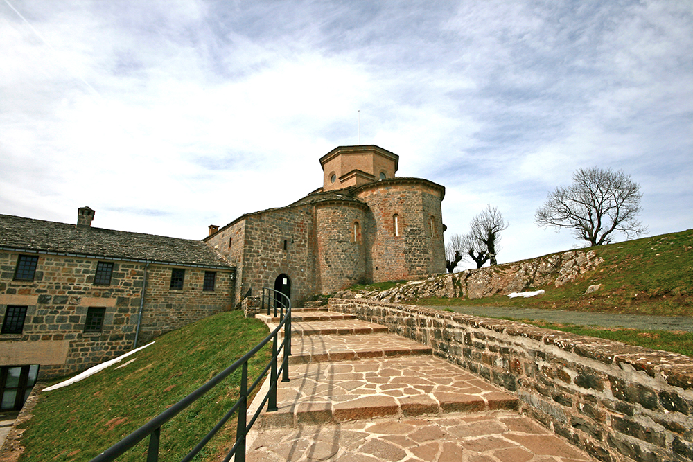
Ruta 24 San Miguel de Aralar
- Salida Iribas
- Distancia 20,0 km
- Desnivel 615 m
ITINERARIO CIRCULAR QUE DESDE IRIBAS, Y POR BURNIGURUTZ Y EL VALLE DE ATA, NOS LLEVA ENTRE HAYEDOS Y PRADERAS HASTA EL LEGENDARIO SANTUARIO DE SAN MIGUEL. SU LONGITUD Y DESNIVEL LO HACEN RECOMENDABLE SÓLO A INICIADOS Y SE DEBE PRESTAR ATENCIÓN EN LOS ABUNDANTES DÍAS DE NIEBLA.
La mayor parte del sendero discurre por el trazado que asciende desde el valle de Araitz y Larraun hasta el Santuario de San Miguel de Aralar. El paisaje nos muestra los perpetuos verdes, gracias a la continua lluvia y a la humedad, combinados con los colores ocres en la estación de otoño. La ruta comienza en Iribas. De esta localidad salimos en dirección Sur, dejando a la izquierda la iglesia.
A los dos kilómetros llegamos al nacedero de Aitzarrateta e iniciamos el ascenso. Un kilómetro después, encontramos el dolmen de Txoritxoberri. Continuamos el ascenso bajo el hayedo y en kilómetro y medio llegamos al collado de Burnigurutz. En el descenso hacia el valle de Ata encontramos los dólmenes de Izeñiturri I y II y Sekoain I y II. Llegamos al valle de Ata y cruzamos el riachuelo. Poco después iniciamos el fuerte ascenso hasta Apezaren malkorra, desde donde ya se divisa el Santuario (1.237 m), al que llegamos en menos de un kilómetro. Descendemos por la carretera de Lekunberri hasta la altura del km 15. A la derecha una senda nos introduce al hayedo y desciende en flanqueo, por senda poco definida hasta la carretera, más abajo del km 9. La atravesamos continuando por sendas hasta llegar a un pista de hormigón que nos conduce a Baraibar y por pista parcelaria entre prados a Iribas.
de Interés
Santuario de San Miguel
Este santuario es uno de los centros de espiritualidad más antiguos de Navarra. Se trata de un templo románico cuyo edificio actual se inició en el siglo XI. La sobriedad decorativa pasa desapercibida ante la joya escultórica que alberga su nave central: un retablo de orfebrería y esmaltes del siglo XII.
Cómo llegar
Dirigirse hasta Lekunberri por la A-15 dirección Donostia-San Sebastián. Una vez allí, por la NA-7504 se llega a Iribas.
Ruta 25 Sendero de los Dólmenes (largo)
- Salida Etxarri-Aranatz
- Distancia 14,9 km
- Desnivel 610 m
SENDERO CIRCULAR, QUE DESDE EL CAMPING DE ETXARRI-ARANATZ PERMITE VISITAR UNA DECENA DE DÓLMENES EN UNA RUTA QUE DISCURRE POR BOSQUES DE ROBLES Y HAYAS, POR REGATAS Y ZONAS DE FÁCIL ENCHARCAMIENTO EN ÉPOCAS DE LLUVIAS. RECOMENDABLE SÓLO A INICIADOS.
Nos situamos en el camping de Etxarri-Aranatz. De este mismo punto parten otras rutas, también balizadas, de menor longitud. Tomar la pista que discurre a la derecha del camping, hasta un cruce a 1,8 km de distancia, desviarse y atravesar el puente de la regata Iraigorri. A los 3 km llegamos a la ermita de San Adrián. Ascenso por senda entre matorrales y bosque hasta el dolmen Beitzeta. La ruta continúa por camino, en ocasiones poco definido, encontrando más dólmenes (Iruiturrieta, Jentilzulo, Bentatxar ) hasta el Alto de Irumugarrieta, con buenas panorámicas.
Seguimos por la cresta que limita Navarra y Guipúzcoa hasta el dolmen de Zelatamuno, Mintegitxuta y en el de Txaragordi descendemos hasta un cruce de caminos. Tomamos el de la izquierda que nos conduce al Collado de Olano, con restos de una borda. Ascendemos hasta el dolmen Fagamendi y seguimos hasta el dolmen Maitzegur, donde se inicia el descenso cada vez más pronunciado en zig-zag hasta una bifurcación. Continuamos por el camino de la izquierda hasta una puerta de hierro y la carretera de regreso al camping. Existe una variante que acorta el recorrido
de Interés
Monte Beriain o San Donato
Enfrente de la sierra de Aralar encontramos la estribación montañosa de la sierra de Andía, cuya cumbre más importante es la de Beriain, con una altura de 1.493 m. San Donato destaca por una peculiaridad geológica, ya que se trata de un sinclinal colgado, producido tras una fuerte erosión kárstica que ha hecho desaparecer los anticlinales.
Cómo llegar
Tomar la A-15 hacia Vitoria y en Irurtzun la Autovía de la Barranca hasta la salida 40 Etxarri-Aranatz
Ruta 26 Itinerario de los Montañeros
- Salida Urbasa
- Distancia 3,80 km
- Desnivel 205 m
SENDERO INTERPRETATIVO DE TRAZADO LINEAL POR UN HERMOSO HAYEDO; AL FINAL DE LA ASCENSIÓN SE OBTIENE UNA GRAN PANORÁMICA DEL VALLE DE SAKANA-BARRANCA, ARALAR Y AITZGORRI. BALIZADO EN VERDE, PERO SIN NUMERACIÓN DE SENDERO LOCAL.
Iniciamos nuestro recorrido en el Centro de Información. Atravesamos algunos rasos en los que encontramos ejemplares de hayas, arces y espinos. A nuestra izquierda, vemos una chabola pastoril, como otras muchas que hay en la sierra para acoger a los pastores en las trashumancia con sus ganados. Se encuentran en los espacios denominados majadas, donde se cobijan pastores y rebaños. Habitualmente se localizan en lugares resguardados del viento, del frío y de la humedad del norte, y cercanos a lugares soleados o con agua. Pasaremos junto al camino de Gazbidea, llamado también de las vagonetas, porque se utilizaba para extraer las traviesas con las que construir las vías del tren. También en la zona se localizan varias carboneras. Tras atravesar el raso, iniciamos el ascenso por el hayedo de Zuzorkil y Mandaberardia hasta los 1.113 m entre Artzanbaratza y Balankaleku. Es uno de los hayedos más húmedos de la sierra y con unos ejemplares que superan los 20 m. El bosque se mezcla con la espectacularidad de las rocas calizas, proporcionando unas estampas llamativas. Pero las mejores panorámicas llegan desde la cumbre, con el valle de Sakana-Barranca, flanqueado por San Donato al Este y la Sierra de Aralar al Norte. Regreso por el mismo camino.
de Interés
Centro de Información de Urbasa-Andía
No lejos del comienzo de esta ruta encontramos el Centro de Información de Urbasa-Andía. Su objetivo es dar a conocer las formas de vida de los primeros pobladores de la zona, así como informar sobre la explotación tradicional de estas sierras, su climatología, su relieve, la fauna y la flora. En el centro se informa de rutas por Urbasa.
Cómo llegar
Autovía a Vitoria hasta Altsasu/Alsasua. Girar por la NA-718 por el Puerto de Urbasa hasta el Centro de Información del Parque
Ruta 27 Itinerario de las Fuentes
• Salida Urbasa
• Distancia 4,50 km
• Desnivel 45 m
SENDERO INTERPRETATIVO DE TRAZADO CIRCULAR QUE PERMITE CONOCER LA DINÁMICA DEL AGUA EN EL TERRENO KÁRSTICO DEL PARQUE DE URBASA, Y SU APARICIÓN EN LOS MANANTIALES. ITINERARIO SEÑALIZADO CON BALIZAS AZULES, PERO SIN NUMERACIÓN DE SENDERO LOCAL.
La ruta comienza en el Área de Interpretación (Borda de Severino), junto a la carretera general y discurre por varias fuentes de la sierra de Urbasa. Cuando el abundante agua filtrada al interior de la montaña choca con las margas impermeables, tiende a salir originándose estas fuentes. El interior de la sierra almacena unos 1.200 Hm3 de agua. La primera fuente que visitamos es la de los Mosquitos, quizá la más conocida por su fácil acceso. Continuamos y, a la izquierda del camino, vemos el haya de la Virgen. En breve encontramos a la derecha una segunda fuente, la de Gortasoro, cerca de la cual se han encontrado útiles prehistóricos de hace cien mil años. Al llegar a la Fuente de Arafe, nos separamos del Itinerario de los Pastores, abandonando la línea marcada por el tendido eléctrico para girar a la izquierda. Tras cruzar con atención la carretera de Zudaire, encontramos la fuente del Arenal en una uvala hundimiento kárstico). Desde este punto, avanzamos hacia la fuente de Basauntziturri. Seguimos hacia el Regajo de los Yesos y pasado el puente se asciende hacia la mesa panorámica.
de Interés
Urederra
El nacedero de Urederra es una reserva natural de 119 hectáreas entorno al manantial donde nace el río Urederra. Es una importante vía de escape del acuíferos que forman las sierras de Urbasa y Andía, pero también es una zona de amplia biodiversidad, debido a su peculiar forma de gran circo natural.
Cómo llegar
Autovía a Vitoria hasta Altsasu/Alsasua. Girar por la NA-718 por el Puerto de Urbasa hasta el Área de Interpretación del Parque.