


 Fotografía cedida por Gobierno de Navarra
Route 1.- Basari y Foz de Burgui
- Departure: Burgui
- Distance: 8,65 km
- Unevenness : 150 m
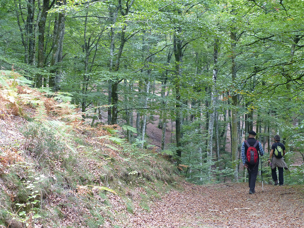
WOOD AS A NATURAL RESOURCE IS THE MAIN PROTAGONIST OF THIS SET OF TWO THEMATIC TRAILS THAT RUN ON THE LEFT MARGIN OF THE ESKA RIVER, IN THE MUNICIPALITY OF BURGUI DEL VALLE DE RONCAL. MARKED ITINERARY, BUT WITHOUT BEACONS OR LOCAL PATH NUMBERING.
The beauty of the landscape of the area characterizes this beautiful route. The first section is a wide and comfortable circular itinerary that allows you to visit the Abetal de Basari, learn about its exploitation and its subsequent relationship with the world of almadia. The raft is a raft made of wooden logs, whose function is to guide the logs themselves through the rivers from the exploitation forests of this sector to the loading points for transport or to the sawmills. After this first 6 km itinerary, you will reach a round trip that, after a stretch of narrow and very wide path that requires some skill, ends at the Foz de Burgui viewpoint. This path allows you to observe the birds that inhabit the cliffs of this sculpture carved into the rock thanks to the fluvial erosion of the river Eska. The medieval bridge of the town sets the starting point of the route where you can also see the reproduction of a raft.
Of interest
The Almadia Museum
The Burgui City Council has two floors set up as a permanent exhibition in homage to this raft that was the life and work of many people from Roncal since time immemorial. Since its foundation in 1992, the Cultural Association of Almadieros Navarros has carried out a process of recovery and conservation of heritage related to the old trade of almadiero.
How to get
Take the N-240 to Lumbier. Then go to Navascués by the NA-178 (Puerto de las Coronas) and from there to Burgui by the NA-214.
Route 2.- Camino de Zemeto
- Departure: Isaba
- Distance: 4,23 km
- Unevenness: 100 m
CIRCULAR PATH IN THE UPPER PART OF THE BELAGUA VALLEY, OF GREAT LANDSCAPE AND NATURAL INTEREST, THROUGH HAYEDO-ABETAL AND PASTURE ZONES, WHICH ALLOWS OBSERVING THE GLACIER MODELING OF THE HIGHEST NAVIGATION ZONES OF THE PYRENEES. SIGNED ITINERARY, BUT WITHOUT APPROVED NUMBERING.
The start of the route is located at the Belagua refuge (currently closed), next to P.K.18 on the Isaba to Arette road; given its altitude, its access may be closed in winter due to snow. There is a large parking lot and helipad. After a gentle descent between pastures, the path reaches the Zemeto pass on the right, a narrow corridor of glacial modeling, an authentic gateway to the Belagua ravine. We turn right, maintaining the height along a cobbled path that reaches a landing. A short detour to the left will bring us closer to the edge of the ravine, with wide views. Back on the road, we find a brief ascent to cross a stream after which a new “balcony” to the Belagua valley offers us the best views of the route: high areas of Larra, the Belagua valley and the haughty peak of Lakartxela. By blurred path you reach km 17 of the NA-1370 highway, near the Yeguaceros barracks. Glued a few meters to it, we link up with the old Puerto Grande road that, between pastures, reaches the fields located at the foot of the Belagua refuge, the beginning of the path.
Of interest
The Belagua valley
It is the head of the Roncal Valley, in its section traveled by the Belagua River to the town of Isaba. Geologically stands out for being a glacial valley, with the characteristic plain at its bottom. The vegetation of this rainy valley is also peculiar, since it has important forests of Scots pine and extensive beech trees with fir trees.
Cómo llegar
A-21 and N-240 until the turnoff to Lumbier, to continue on the NA-178 and NA-214 to Burgui. From there to Isaba NA-137 and NA-1370 to Belagua and Arette.
Route 3 Embalse de Irabia y Paraísos
- Departure: Orbaitzeta
- Distance 11,30 km
- Unevenness: 175 m
THE IRATI FOREST IS THE FRAMEWORK OF THIS PATH THAT, SURROUNDING THE IRABIA RESERVOIR, RUNS IN ITS PRACTICE IN ITS ENTIRETY TO THE SHELTER OF THE HAYEDO-ABETAL, ALTERNATING SECTIONS OF FOREST TRACKS AND OLD WOODWORKING PATHS.
The route proposed here, whose only unevenness can be found at the end of the route, is made up of two local trails (S.L.) marked in green and white. At the gates of the Navarrese Pyrenees and in the heart of the largest beech-fir forest in Europe, with 17,195 hectares, lies the Irabia reservoir that collects the waters of the Irati River. The first route called “Embalse de Irabia” is flat and runs around the perimeter of the reservoir with a short section of track where the entrance to the dam is located, and it is here that you can access a beautiful path on the left bank to the House Forest. After a long stretch of wide track, you cross the Egurbio bridge and turn, continuing along the shore of the reservoir. Before reaching the dam, turn right onto the Paraísos-Erlan trail (SL-54C). The Paraísos-Erlan path ascends halfway up a slope along a path that crosses one of the best areas of Irati forest and in some clear section offers wide views of the whole of the Irabia reservoir. After a steep descent, it connects with the cement track from Orbaitzeta and through which we return to the beginning of the route, next to the dam.
Of interest
El embalse
The reservoir regulates the waters of the Irati River. It is a small dam, which was built in 1921 to control the water, produce energy and allow the wood to float, which at that time was lowered in the form of a raft towards the Ebro. The Irati is formed by the confluence of the Urtxuria streams and Urbeltza, with very pure waters. This is attested by the presence of almost extinct species such as the Pyrenean desman.
How to get
To France via the N-135 and, after passing Aurizberri / Espinal, follow the NA-140 to Aribe. From there on the NA-2030 to Orbaitzeta and detour to the Irabia reservoir (13 km).
Route 4 Koixta y Akerreria
- Departure: Ochagavía
- Distance: 11,15 km
- Unevenness: 525 m
THE REGATTA OR URTXURIA RIVER, WHICH TOGETHER WITH URBELTZA GIVES ORIGIN TO IRATI, IS THE AXIS OF THIS ITINERARY WHICH RUNS IN ITS ENTIRETY THROUGH THE FOREST. THE INITIAL SECTION, VERY COVERED, REQUIRES ATTENTION AND CERTAIN SKILL; THE FINAL DESCENT IS DONE BY A STEEP FOREST TRACK, THEN DIVERING TO THE VIRGEN DE LAS NIEVES HERMITAGE.
The union of three local trails gives rise to this fabulous journey into the magic of nature. The trail begins near the hermitage of the Virgen de las Nieves, next to the information and guard post: it is the old road from Casas de Irati to the Koixta sawmill, going up the left bank of the Urtxuria regatta with an initial route along a narrow path with abrupt slopes, a wide forest track to the Koixta bridge, where there is a small dam and the Urtxuria is crossed. From here, the return to Casas de Irati and Virgen de las Nieves begins on the right bank of the Urtxuria regatta, following the path of the forest track that replaces the old path with a detour to the interesting viewpoint of El Boche-Akerreria. The last thematic section with signs indicating tree species runs next to the Virgen de las Nieves hermitage and descends through the old Irati Houses, to the bridge over the Urtxuria regatta, the starting point.
Of interest
Ermita Virgen de las Nieves
Located 23 km from Ochagavía, the building is an exceptional viewpoint of the Irabia reservoir, which collects the crystalline waters of the Irati River. Pilgrims from Roncal, Salazar and Aezkoa come to the Sanctuary, who devoutly attend the pilgrimage on the Sunday before August 15. Just 100 m away you can visit the ruins of the Casas de Irati or Casas del Rey where the forest guards had their residence.
How to get
N-240 towards Jaca and take the NA-178 to Lumbier and Ochagavía, at the entrance of which you will find the detour to Irati (NA-2012).
Route 5 Altos de Abodi
- Departure: Ochagavía
- Distance: 6,27 km
- Unevenness: 200 m
ITINERARY THROUGH THE CIMERAS AND LARGE MOUNTAIN GRASSLANDS OF THE SIERRA DE ABODI, WITH BEAUTIFUL VIEWS OF THE IRATI JUNGLE AND THE PICO DE ORI. NOT RECOMMENDED PATH WITH POOR VISIBILITY OR FOGS.
The “Paso de Tapla” is located on the NA-2012 road, 14.5 km from Ochagavía and during winter it may be closed due to snow. From this point the path runs along the southern face of the Sierra de Abodi. From Tapla, this circular path gradually ascends to the Altos de Abodi with beautiful panoramic views of the Irati Forest and Mount Ori, until it reaches the Alforjas pass, named for the two sinkholes (large funnel-shaped depressions) located in the. Here, the route connects with the GR-11 (“Senda Pirenaica”, marked in red and white) and a few meters later it passes by the Arrizabala menhir (lying on the ground). The return is made by an old track that crosses a beech forest in the middle of the slope until it reaches the road and returns through it to the starting point. The path that runs along the ridges of Abodi offers beautiful views of the Salazar Valley and the Irati Forest.
Of interest
El Pico de Ori
Above the Selva de Irati rises the summit of Ori (2,021 m), the first peak to exceed 2,000 m in the Western Pyrenees. It can be reached in 45 minutes from the port of Larrau. We find this mountain, which appears above the Irati Forest, very attractive for mountaineering. In winter the road only opens up to Pikatua, where the Abodi Nordic ski center is located.
How to get
On the N-240 towards Jaca. Deviation through NA-178 to Lumbier and Ochagavía. At the entrance there is the detour to Irati by the NA-2012.
Route 6 Arlekia-Lauzaran
- Departure: Orbaitzeta
- Distance: 6,52 km
- Unevenness 340 m
THE NATURAL BEAUTY OF THE IRATI FOREST AND THE HISTORY OF THE FORMER WEAPONS FACTORY SMELL IN THIS HUMID ENVIRONMENT IN THE HEART OF THE PYRENEES NAVARRO. IN THE IMMEDIATION YOU CAN VISIT THE AZPEGI MEGALYTIC STATION, LOCATED ABOUT 3 KM FROM THE FACTORY.
This circular path ascends from the Orbaitzeta weapons factory to the cordal and the Lauzaran pass, an area of limestone rock completely covered by the beech forest; During the steep ascent along a charcoal trail, you can visit the Lauzaran Castle and the Grotto of Lutoa. After crossing an area of pastures, the itinerary descends steeply through a beech forest with abundant remains of charcoal squares. Having reached the bottom of the Itolatz ravine, the itinerary descends along the river along a wide forest track to the Orbaitzeta arms factory, the end of the route. Given the dilapidated state of the facilities, caution is advised during your visit. Except in the snow season, access is good. At the entrance to Irati by Larraun, there is an information stand and a nursery staffed in the busy tourist season.
Of interest
The arms factory
It was two centuries ago the main military industrial center in northern Spain. Created in 1785, it was operational until 1873 after suffering numerous fires. The factory was designed by military experts from the artillery corps. Cast iron bombs, grenades and ammunition of different caliber were manufactured. In the middle of the 19th century, around 40 workers worked in the Orbaitzeta armory.
How to get
Head towards France on the N-135 and, after passing Aurizberri / Espinal, follow the NA-140 to Aribe. From there, access to Orbaitzeta by the NA-2030
Route 7 Camino a Irati y Muskilda
- Departure: Ochagavía
- Distance: 6,84 km
- Unevenness: 320 m
A CIRCULAR PATH THAT, AFTER A SOFT ASCENT THROUGH THE FOREST ON THE OLD ROAD TO IRATI, TURNS BRUSHLY AND WALKS THROUGH CORDAL TO THE HERMITAGE OF MUSKILDA, PLACE THAT, NEXT TO SAN SALVADOR DE IRATI AND ORREAGA / RONMANCESVALLES, FORMS THE SEGIALLES FORM. MYTHOLOGICAL BELIEF, “BASAJAUN”, THE LORD OF THE FORESTS, WAS ENCLOSED.
To begin the tour, you have to stand at the back of the Ochagavía church where a cobbled street leads up to the last houses in the town. Then, take a path to the left of the beginning of the road direct to Muskilda. The path advances to the middle of the slope, with little slope, among dense vegetation of hazelnut trees, oaks, maples, chestnut trees, linden trees, dogwood trees, etc. through an area that was cultivated until a few years ago and is currently being colonized by the forest. The path leads to a wide path, which goes into a thick beech forest. In this way, you reach a not very marked hill, already in clear terrain, where the Xubri hut is located. The itinerary changes direction and continues along a track among beech trees, until it reaches the road that ascends from Ochagavía to Muskilda. You have to cross it and continue along the wide path that goes up until you reach a small water reservoir; the path turns into a narrow path, which leads us to the Shrine of Our Lady of Muskilda. The descent to Ochagavía takes place along a cobbled path, witness to a traditional pilgrimage.
Of interest
Ochagavía
Located north of the Salazar valley, Ochagavía is one of the most typical towns in the Navarrese Pyrenees. Between the Zatoya and Anduña rivers and surrounded by mountains, it stands out for its historic houses emblazoned between cobbled streets that lead to the medieval bridge. The town is located next to the Irati forest, joining art and history with nature during its visit.
How to get
N-240 towards Jaca. Take the detour to Lumbier and there the NA-178 through the Salazar Valley to Ochagavía.
Route 8 Mirador de Erondoa
- Departure: Garralda
- Distance5,50 km
- Unevenness: 120 m
LINEAR PATH BETWEEN THE VILLAGES OF GARRALDA AND ARIA (VALLE DE AEZKOA). A GOOD PART OF THE LAYOUT GOES ON A HORSESHOE PATH NEXT TO THE COVERED MIRADOR DE ERONDOA, IN AN AREA OF ROQUEDO CALIZO. AFTER VISITING THE TOWN OF ARIA AND ITS PECULIAR HORREOS, YOU RETURN BY THE SAME TRAIL.
The trail begins in Garralda, next to the regional school and, after ascending along the agricultural track, reaches the old mule track to Aria. Halfway through the path you reach the Erondoa viewpoint. This route has a covered area with views of Aribe and the valley. It also shows the possibility of observing the birds that inhabit the cliffs. From the viewpoint itself, you can access the top of Erondoa, a modest but steep watchtower of the Aezkoa valley, along a steep and somewhat complicated path. Once you have reached the town of Aria, you can visit its peculiar granaries, with clapboard roofs, witnesses of the harsh Pyrenean life, of grazing and little agriculture. The return is done by the same path. The starting town, Garralda, has a temporary Tourist Information Office.
Of interest
A visit to Aribe
This town is located in the geographical center of the Aezkoa valley and at a crossroads of natural paths that connect all the towns. On the banks of the Irati River, Aribe is the one that is at the lowest altitude. Its medicinal waters are recognized and a spa was built in the middle of the last century that functioned until the 1920s. In Aribe there is the cave of Aizpea or “of the mill” where the complete remains of the oldest woman in Navarre were found with 8,000 years of antiguaty.
How to get
Head to France on the N-135 and, after passing Aurizberri / Espinal, turn off on the NA-140 to Garralda.
Route 9 Mirador de Usetxi
- Departure: Usetxi
- Distance: 4,21 km
- Unevenness: 170 m
CIRCULAR PATH OF SOFT DEVELOPMENT THROUGH ONE OF THE LESS TRAVELED AREAS OF THE PYRENEES NAVARRO. AFTER A FLAT SECTION THROUGH MIXED FOREST, THE ASCENT THROUGH CORDAL HERBOSO IS REWARDED BY WIDE VIEWS TO THE KINTOA-QUINTO REAL MOUNTAINS AND ESTERIBAR VALLEY. NOT RECOMMENDED PATH WITH POOR VISIBILITY OR FOGS.
The starting point is located in the urban area of Usetxi. Take the old mule track of Iragi, with a flat and pleasant path between oaks, scots pines and maples. Thus, little by little you come to a hill from which Iragi can be seen. Here the ascent itself begins through a section with a certain unevenness, but comfortable for hiking enthusiasts. You reach the top of the hill and descend a little to the other side to a fountain with a trough, after crossing a track. Then, along a narrow path with little unevenness, we reach the booth – forest fire observatory, a place especially indicated to rest and contemplate the landscape. Along a little marked grassy section, we descend through a valley until the junction with a path that gently descends to the wide track of Etsain, which leads back to the town, in Usetxi, which lacks basic restaurant services.
Of interest
Zubiri
Zubiri is “the town of the bridge” and capital of the valley. Its name is related to the Gothic bridge (in the image) called “de la rabia”. Animals circling their stirrups were believed to heal from such a disease. They also say that the relics of Santa Quiteria were buried in one of those pillars of the bridge. Next to the bridge, and on the edge of the Jacobean route, is the Santa Magdalena hospital.
How to get
Head towards France on the N-135 until Zubiri, and at the entrance on the NA-2530 for 5 km until Usetxi.
Route 10 Camino del Fuerte Carlista
- Departure: Erro
- Distance: 5,46 km
- Unevenness: 180 m
CIRCULAR PATH ALTERNATING SECTIONS OF TRACKS BETWEEN LARGE MEADOWS AND NARROW PATHS THROUGH MIXED FORESTS. THE HIGH PART OF THE ROUTE COINCIDES WITH A BEAUTIFUL SECTION OF THE CAMINO DE SANTIAGO, FROM WHERE YOU CAN ACCESS THE PROMONORY WHERE THE CARLISTA ARMY BATTERIES WERE LOCATED.
The start of the route is located at the beginning of the track that starts from the Erro church square. We ascend for a short section along this track until, a few meters before reaching a livestock shed, a path appears that borders the fields and meadows. Little by little the path enters the forest of Scots pine, with some stretches that run along the bottom of a lush ravine. After a climb, with the path blurred, the path ends in a wide track. It is a flat section between hills, with the possibility of ascending to the hill called El Fuerte (on the left, unmarked section) to Paso de Roldán, a hill where the Camino de Santiago is abandoned, descending along a wide path. This path leads to the bottom of the Otsobi ravine, which must be crossed by a dirt track to reach the cattle shed at the beginning of the path and return to the beginning. After walking for five minutes up the track to a hill, continue to the left along a path corresponding to the Camino de Santiago.
Of interest
El Mirador de Erro
It is a good observatory to be able to read and interpret the transition of the landscape. In its first foothills, the Agorreta ravine presents a livestock area framed by dense formations of red pines. El Alto de Erro marks the dividing line between the Atlantic climate (west) and the sub-Mediterranean (east). The panoramic view and the viewpoint, a true meeting point for pilgrims, walkers and travelers, are excellent. The visit is recommended to the general public. The port is reached through the N-135 road.
How to get
Head towards France on the N-135 to the town of Erro.
Route 11 Foz de Lumbier
- Departure: Lumbier
- Distance: 6,38 km
- Unevenness: 175 m
CIRCULAR TRAIL THAT ASCENTS TO THE MOUNTAIN RANGE THAT SEPARATES THE LUMBIER AND LIÉDENA BASINS AND DOWN TO THE SHORES OF THE IRATI RIVER, NEXT TO WHICH THE FOZ DE LUMBIER RANKS, CARVED BY THE RIVER IN THE LIMESTONE ROCK.
The trail begins in the reception area and, after ascending by path and then by track, reaches the mountainous ridge, with wide views of the Sierra de Leire and the Lumbier and Liédena basins, where it descends until reaching the old route. Irati train, on the banks of the river. It was in 1987 when this spectacular landscape, together with the group that forms the Sierra de Leire and the Foz de Arbayún, received the designation of Natural Reserve. There is a reception and information area, as well as an Interpretation Center in Lumbier. Following the old railway route and after leaving the Puente de Jesús (or Devil’s Bridge), now demolished, on the left, the first tunnel on the route is crossed. This is how you access the interior of the gorge, whose rocky cliffs of reddish, whitish and grayish tones contrast with the green of the vegetation of holm oak, boxwood, juniper, hawthorn and tufts of rock tea, and are home to a large colony of griffon vultures. . At the end of the gorge, another tunnel is crossed, after which one reaches the reception area, the beginning of the route. This last section, on the platform of the old railway, is by itself an attractive and easily accessible walk.
Of interest
The Irati train
Originally thought to transport the wood exploited in the Irati forest, from Aoiz to Pamplona, the project was soon extended to Sangüesa. It was one of the first European electric traction railways and began operating on April 23, 1911.
How to get
N-240 towards Jaca. After the port of Loiti, cross to Lumbier on the NA-178. At the entrance, asphalt road to Foz.